|
Home - The Village Today - History - Maps - Memories - Newspapers - Picture Gallery - World Wars |
|
Home - The Village Today - History - Maps - Memories - Newspapers - Picture Gallery - World Wars |
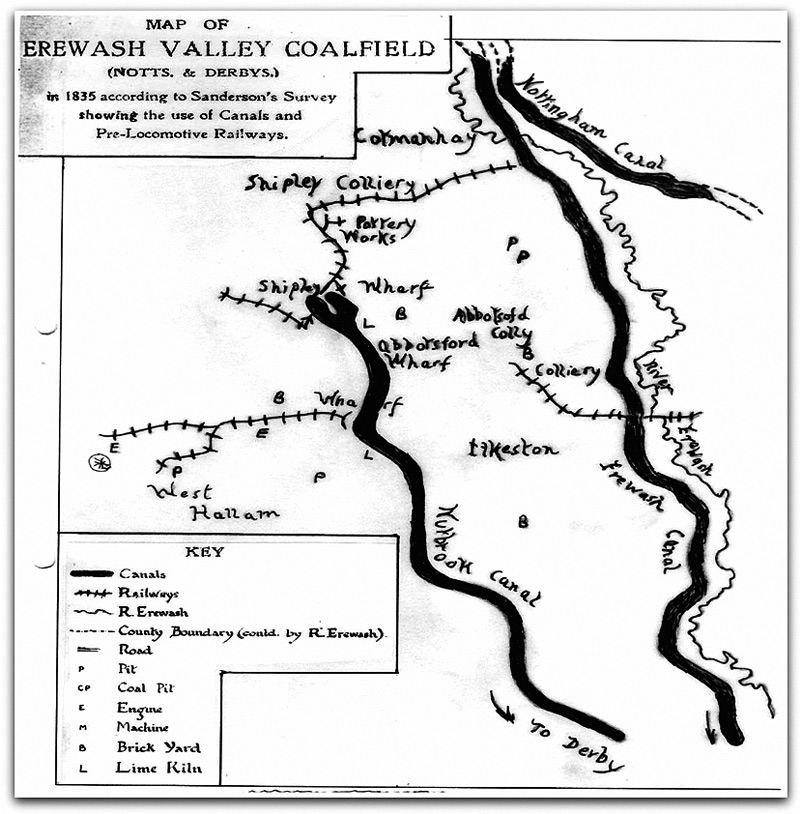
Simonfield to The Brook The Canal Age The downfall of the Simonfield coalfield came with the opening of the Canal System. The Erewash Canal opened to the East in 1779. With Miller Mundy of Shipley quickly laying down a wooden railroad to Newmanleys Mill on the Erewash at Shipley Gate. Opening up new markets for his coals from his Shipley Colliery. To the West came the Derby Canal following the Act in 1793 allowing the Little Eaton Branch to be built. This promised to lay a horse drawn railroad to Smalley, with the expectation that Simonfield coal could be moved by a tramway link to the Little Eaton Canal Wharf, but this never materialised. Seeing the huge potential in canals Miller Mundy of Shipley along with Sir Henry Hunloke .(later continuing with Francis Newdigate when he purchased the West Hallam estate in 1822) invested money in the Nutbrook Canal project. Giving them the opportunity to open more collieries in their Lordships. The canal opened in 1796 joining with the Erewash Canal at Stanton. Tramways and Collieries were soon opened throughout the area.
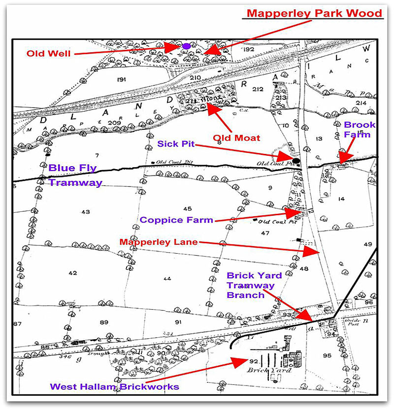
MAP OF TRAMWAY This enterprise again resulting in Simonfield being isolated with no rail network allowed to join up with the Nutbrook. Park Farm had been the main farm and stables for Simonfield tramway horses. This practice continued when the Blue Fly Tramway opened. A horse hospital was built adjoining the stables to care for sick and injured animals. Accommodation was also built on the West side of the farm house for the stable lad. This had a small kitchen and upstairs bedroom. The lad cleaned out the stables, fed and watered the horses and prepared them for a days work.
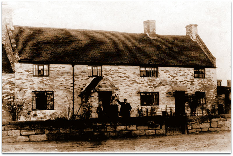
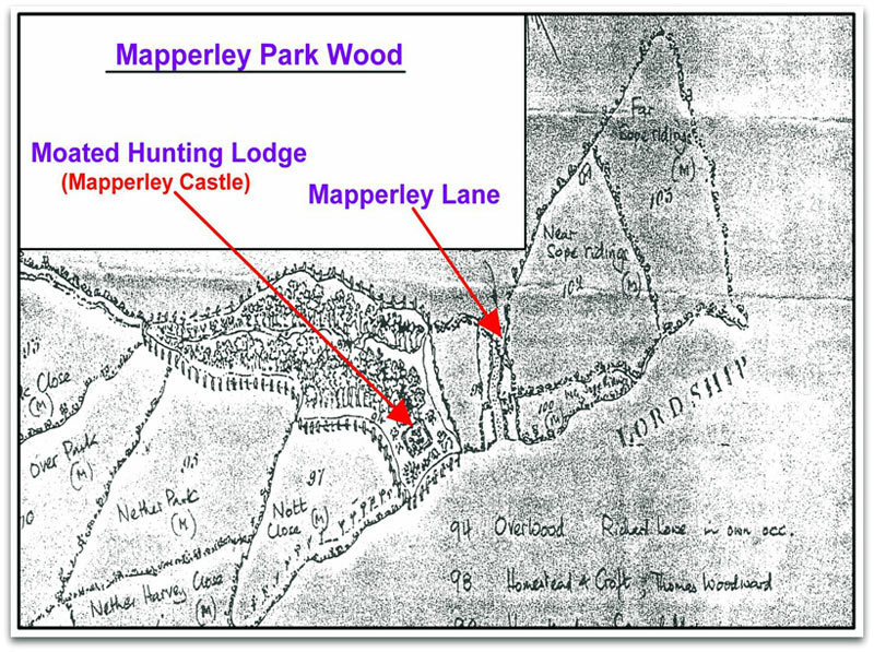
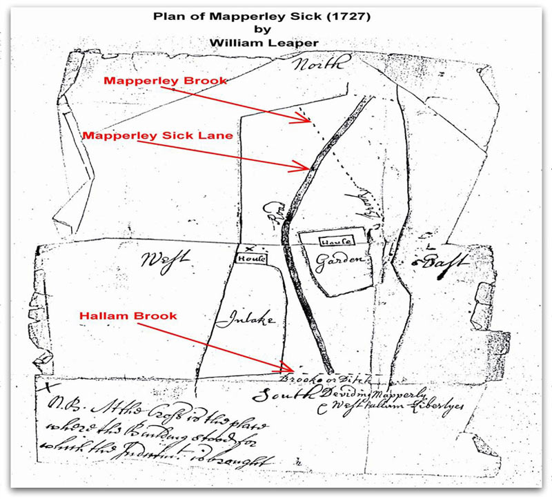
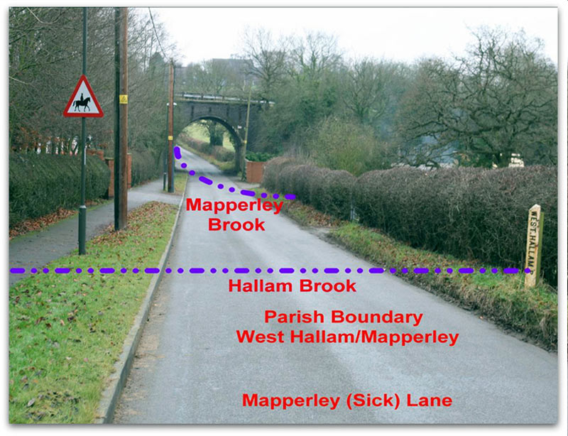
Park Farm Supplying horses for working the collieries continue when the Simon Pit arrived. Horses were then needed above and below ground. This would take another 73 years before deep mining would take place in Simonfield with the arrival of the Glendon Iron Company signing a contract in 1869 to open a New Colliery on the Old Park Hall Estate. ……………………. Mapperley Sic (Sick)What and Where is Mapperley Sic? Sic is an Anglo Saxon word meaning a Stream or Brook. Hallam Brook is the Parish Boundary stream, between West Hallam/Mapperley. (Shown and marked on the photograph note the boundary post). When the mineral railway line was constructed in 1872, by the Mapperley Colliery Company, for transporting coal from their Simon Pit. Mapperley Brook was realigned, with a new culvert built under the road. These two brooks meet at Brook Farm. (Hence the name). From this point the brook flows eastwards using the name Mapperley Brook.
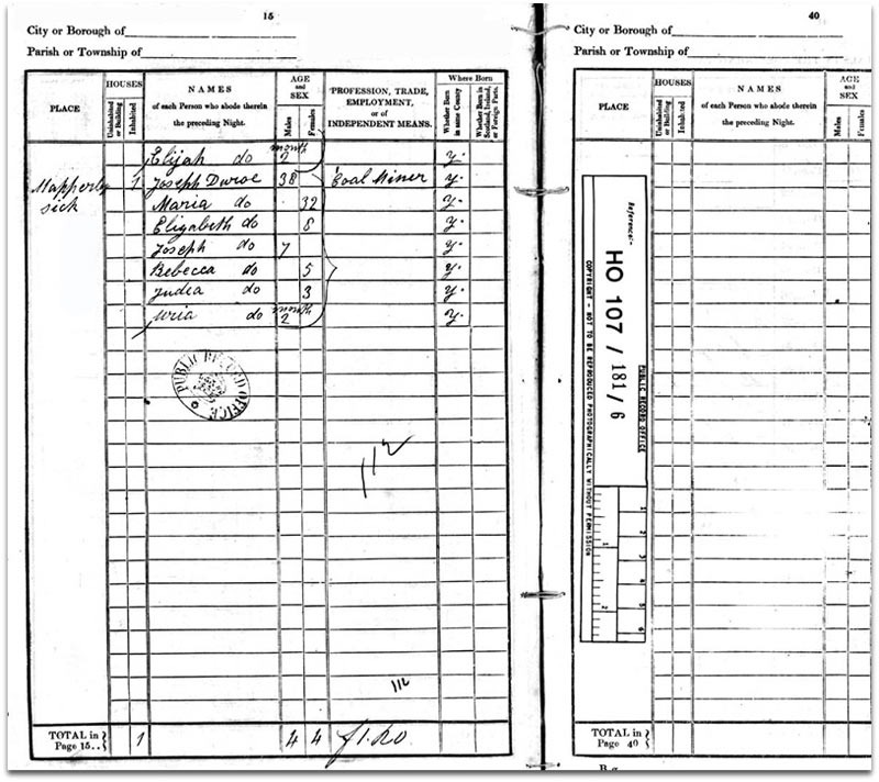
Looking at a page from the 1841 Census we see Mapperley Sick Lane listed and the Duroe family listed.
So Where is Mapperley Sick? The case against Dr. Wilmot v Freeholders of Mapperley dated 5th August 1727. Stating that about 60 years before (1666). All the Sick was Common Land and Open without any building or closures upon it. Zachary Wathey and his son Samuel gave evidence at the trial. This area was also known as the “Slang” A narrow strip of Land. “The Land between the two Culverts”
Disclaimer - Copyright - Is this page correct? Something wrong or missing? Please let me know. Also contributions very welcome |