|
Home - The Village Today - History - Maps - Memories - Newspapers - Picture Gallery - World Wars |
|
Home - The Village Today - History - Maps - Memories - Newspapers - Picture Gallery - World Wars |
Ref No: DCER000473
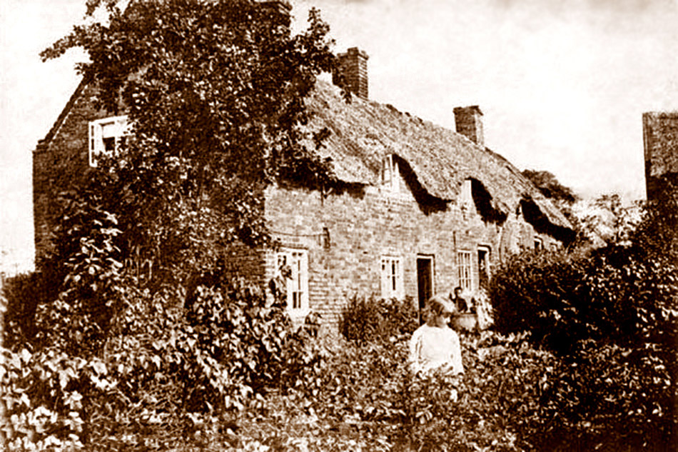
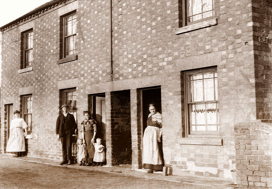
The cottages were located opposite The Royal Oak Pub (now a house) near Park Hall and Mapperley Colliery. They are viewed from the rear looking ENE.
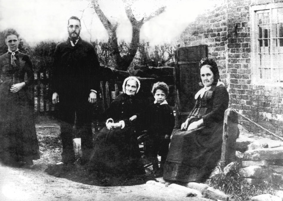
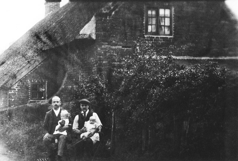
The above is the photo as described by a lady named S March. She says it is known in her family as 'the five generations' The little boy is John William Singleton, son of William Singleton and Ruth Hannah, nee Holmes, who is standing on the left side. Her father, Wolstan Holmes is the large gentleman in the middle. To the far right is his mother, Sarah, nee Harvey and the remaining, very elderly lady is her mother. Hannah nee Hawley. It was thought the photo was taken on her 100th birthday (her birthday was June 29th) but in fact she passed away 3 weeks prior to this. The photo is thought to have been taken 1889-90
Reginald Harvey, Park Hall, 1920
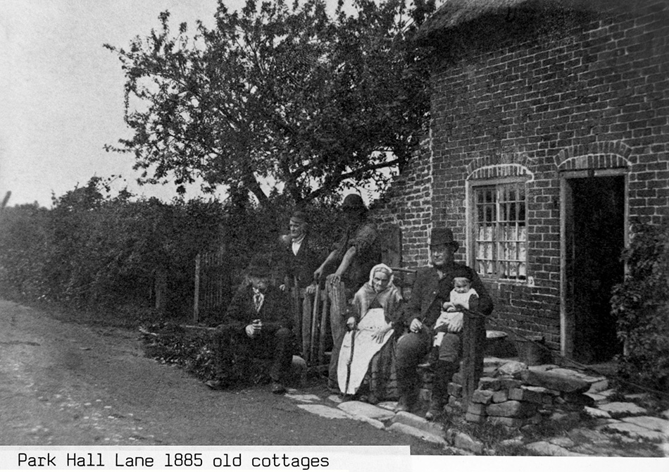
Park Hall People Outside Cottages
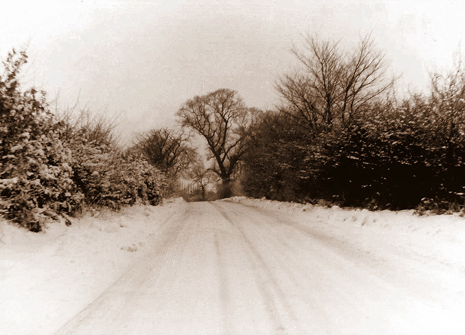
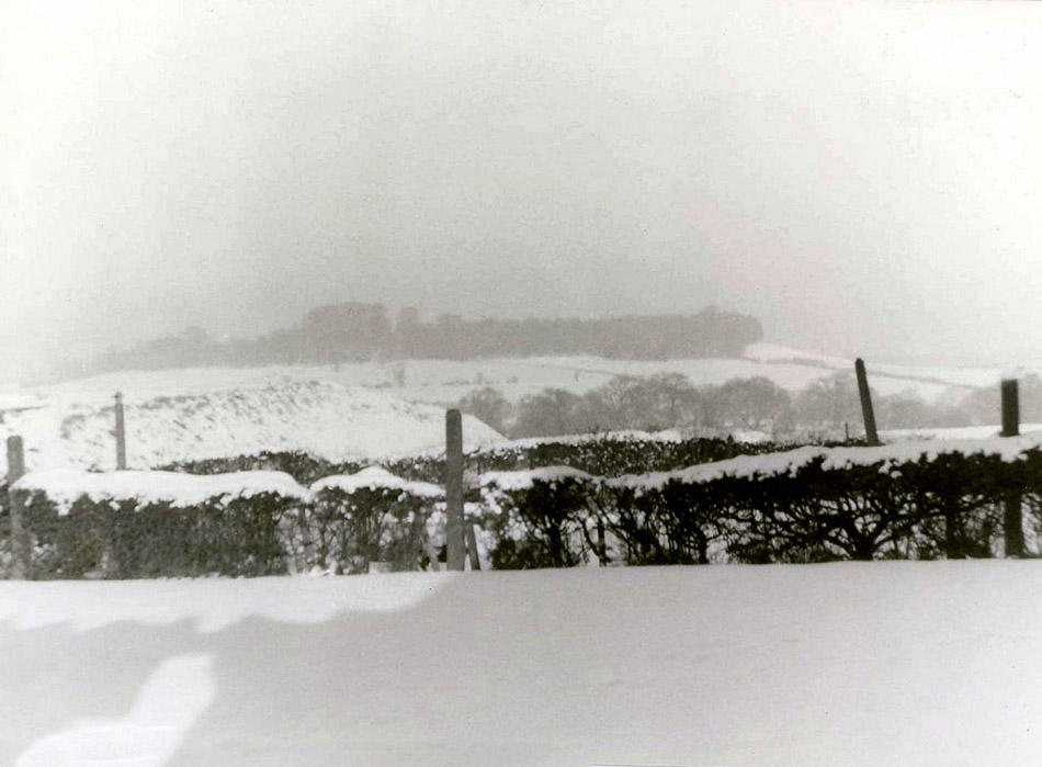
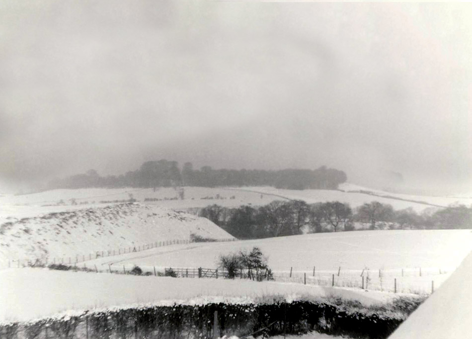
Park Hall Lane, March 1978
Park Hall Lane, March 1978
Park Hall Lane, March 1978
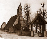
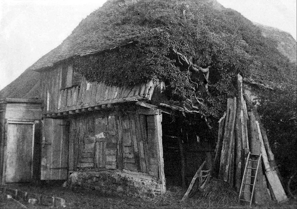
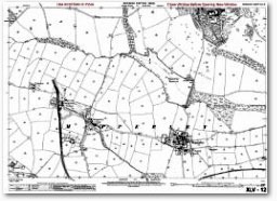
Old Building Believed to be at Park Hall Park Hall Farm was built on the site of our oldest settlement. A moated Manor House owned by Simon Adherne. Simon received a Royal Charter by Henry III in 1267. Allowing him as Lord of the Manor to hold an annual fair to be held at the festival of the Holy Trinity, always falling in May or June. (Trinity Sunday falls in May or June. Eight weeks after Easter Day. The earliest possible date being May 17th. The latest possible date June 20th). Making this a right to hold a fair, which is even older than Ilkeston. Also he could hold a weekly market every Monday. An attack on his manorial rights took place three years later in 1269. Ralph Cromwell (Lord of the Manor of West Hallam) carried this out. He organised a group of men to ransack the Hall and throw down, and carry away Simon's Gallows, stocks and Pillory which Simon had erected under his interpretation of the Royal Charter. Although the road leading from West Hallam crossroads to the Park Hall Hamlet is today officially sign-posted Park Hall Lane, to all the locals it is referred to as Simon Lane. The fields to the west of the farm leading to Smalley, are also still identified on all ordnance survey maps as "Simonfields". Today the farm is owned by the Morgan family. Mapperley Colliery, known of course as the Simon Pit. Shaft sinking began in 1870, the first coal turned in 1872. The colliery closed in 1965 after providing employment for hundreds of men from all the surrounding villages. Park Farm owned by several generations of the Shaw Family. This farm looked after all the pit ponies for the colliery. Injured horses were brought to the surface and treated in the "Horse Hospital". A purpose building, whose ruins can be seen at the rear of the farm. A small annexe, built on west-end of the farmhouse consisted of a downstairs kitchen, complete with upper bedroom, built as a home for the stable lad. Observing the horses brought to the surface during the collieries annual fortnights' holiday was a delight, being in the daylight for the first time, after spending months underground sent them crazy, causing them to gallop around the fields like young foals. To the right of the farm is a row of Houses. The extreme building was once a Public House called "The Royal Oak". Always clearly signed "Royal Oak" it was never called this by the locals. This pub was always "The Candlesticks". The name goes back to the days before electric and gas lighting. Back to the days of the "Candelabra". Apparently the pub had only one set, always placed at the bar. Once the customers had been served their drinks the landlady would walk away from the lounge carrying her only source of light with her leaving the customers sitting in the dark. Hence the name "The Candlesticks". Always being a favourite with the miners especially being so close to the pit. The Landlord always knew the end of shift times; he would start pulling pints of beer at the sound of the colliery "Blower". Ready for a rush of miners eager to quench their thirst, and wash down the shifts coal dust. The pub remained open after the pit closure, but business suffered badly. Open-cast operations took place several years later removing all traces of the mine and spoil heap. This work caused serious problems resulting in Methane Gas being detected in the pubscellar. After several months of closure the cellars were finally given the all clear, with this news the brewery tried to sell the premises as a going concern. With no takers the pub was sold as a private dwelling. Roger Wood 2011 Park Hall Lane Taken from the Parish Magazine of January 2006 The road leading from West Hallam Crossroads to Mapperley village is Park Hall Lane but to many locals it is often referred to as ‘Simon Lane’. Most of you will remember Simon Lane Post Office situated opposite Millhouse Garage in a small wooden building. Mapperley Colliery was more often called ‘Simon Pit’ and the fields to the west of the lane leading to Stanley Common are still marked on ordnance survey maps as ‘Simonfields’. Simon was ‘Simon de Arderne, Lord of the Manor of Mapperley at Park Hall in the thirteenth century. In 1267 he was granted a charter to hold an annual fair, to be held each Holy Trinity day; he was also allowed a weekly market, held each Monday. In 1857 Park Hall was described in White’s Directory of the County of Derby as being, ‘A small hamlet half a mile north-west from Mapperley village where once a large mansion stood of which nothing now remains. Roger Wood From the June 1986 Parish Magazine Simon De Arden Received A Grant Of The Manor Of Mapperley On 28 May 1267 According to records in the Derbyshire Assize Rolls Simon de Arden received a grant of the Manor of Mapperley on 28 May 1267 having married the heiress of the Mapperley Lordship. In 1276 he and his wife sold it for £200 a large sum in those days. And well he might, for three years after his settlement an attack was made on his home by Ralph de Cromwell, Lord of West Hallam who, assisted by his men entered Simon's manor and threw down his gallows by force of arms. Simon's seat was at 'Park Hall'—so named from its ancient status. In 1969-70 I was a member of an archaeological dig under the direction of Mr Alan Palfreyman and organised by Ilkeston and District Local History Society. The objective - to find the site of Simon's Manor. As Park Hall Lane is still known as Simon Lane and Mapperley Colliery known as Simon Pit, and adjacent fields known as Simon Fields it seemed logical to look nearby. After one false start we discovered traces of a moat at Park Hall Farm and with the kind permission of the owner, Mr Morgan, commenced to dig up his farm-yard. We were able to establish that Park Hall Farm was indeed the site of a moated fortified Manor house almost certainly that of Simon de Arden. Furthermore the site had been continuously occupied since the 13th century. The original well, 700 years old, supplied water for farm purposes. As well as the moat a wooden defensive palisade was found, probably to keep out wild animals as well as the West Hallam ruffians. Artefacts relating to four distinct phases of occupation were found and identified with the help of the Ministry of Public Works and Buildings. A full record of this excavation was published by the Ilkeston& District Local History Society in 1970. Although now out of print I would be happy to lend my copy to anyone wishing to pursue the matter further. Smalley History and Legends book 1905 Simon Field extract page 70 - 71 “Simon Field” estate derived its name from Simon de Arderne, who received a grant of the Manor of Mapperley with market, fair, and free warren in 1266. It would appear that he had married the heiress of the Mapperley lordship, and that in 1276 he and his wife sold it for £200 (a large sum at that time) to Thomas de Luthe. And well he might sell it, for three years after his settlement, an attack was made on his home by Ralph de Crumwell (of the Wingfield Manor stock, and apparently lord of Hallam) assisted by his West Hallam men, who, by force and arms entered Simon's manor, threw down the gallows he had erected, carried away the pillory; in fact, the " juridicialia" of the Court Leet of a Barony, which Simon's was not. The report of this bold stroke is recorded in the Derbyshire Assize Rolls in the Record Office, but the result does not appear. Simon's seat was at "Park Hall" so named from its ancient status. His mansion, long since destroyed, stood within a quadrangular moat, the greater part of which is levelled in, but the well still remains near the centre, and still supplies water for farm purposes, though not used for domestic consumption. The lower lining of the well is composed of small ironstone laminae very neatly and admirably constructed. Thanks to Philip Wyles for this article. Park Hall Map (1778) (Field Names and Owners) Ref. Dr 84a Rents Due to Richard Lowe Esq. at Lady Day and Michaelmas
Note: Lady Day 25 March. Michaelmas 29 September The Lowe Family and Locko Park John Lowe (1704 – 1771) John Lowe was the eldest son of Vincent Lowe of Denby and Theodosia, daughter of John Marriott of Alscot Gloucestershire. He had purchased the Locko Park Estate from the Gilbert family in 1747. John married Sydney, daughter of Richard Marriott of Alscot. (She died 28th July 1789 aged 80 years). Having no children the Denby and Locko estates passed onto younger brother Richard Lowe. Richard Lowe (1716 – 1785) Richard Lowe was a woollen draper occupying premises in Kings Street, Covent Garden, London. Eventually becoming a leading supplier of Army uniforms for the British forces. Becoming a wealthy man he co-founded in 1771 a bank with partners Raymond, Williams, Vere and Fletcher. Which eventually became Williams Deacon’s Bank. Following the death of his older brother John he inherited the Denby and Locko Estates. Adding to his wealth he purchased property in Smalley, Mapperley and invested in the growing coal industry. In 1778 commissioning William Radford Junior to survey his Park Hall Estate. Providing a detailed map listing his tenants and field names. (Ref. Dr 84a). Richard Lowe died 28th May 1785 aged 69, buried 13th June 1785 in St. Mary’s Church Denby chancel floor. In his will, Richard left his entire estate to his youngest daughter Anne. She could only inherit his vast wealth if she agreed to marry from a number of selected suitors. Her cousins William, Thomas or John Drury, or one of the sons of Edward Miller Mundy of Shipley. Anne totally rejected any of these proposed liaisons and much negation and litigation ensued. Resulting in William Drury (Richard’s cousin) of Nottingham purchasing the estate in 1785. Having agreed to pay Anne £50,000. William Drury then assumed the name Lowe by Royal Sign Manual dated 10th July 1790. William Drury Lowe (1753 – 1827) In 1792 William Drury Lowe gave up to John Radford several properties in Smalley in exchange for Radford’s lands near the Locko estate. But ensured that he could have the right to make railways in, over, or through the said lands in Smalley, in connection with his collieries in the Lordship of Mapperley. Paying full compensation to Mr. Radford for all damage or injury, which shall be done to his lands by the said railways. Drury Lowe ensuring that he would be able to get his coal to market without any complications. The Estate papers and manuscripts for the Lowe’s are held at the University of Nottingham. Listed on the Park Hall Map (1778) are the main tenants:
Showing their lands and homestead locations. Listed living at the Homesteads:
Several of these family names can still be found living in Mapperley Locations of pit shafts, engine houses, the Park Hall Pottery Kiln and Brick Kiln are also all clearly marked. …………………………Roger Wood 10 Dec 2012
Click Map to Enlarge - Double Click to Reduce Disclaimer - Copyright - Is this page correct? Something wrong or missing? Please let me know. Also contributions very welcome |